Anne's Beach, USA
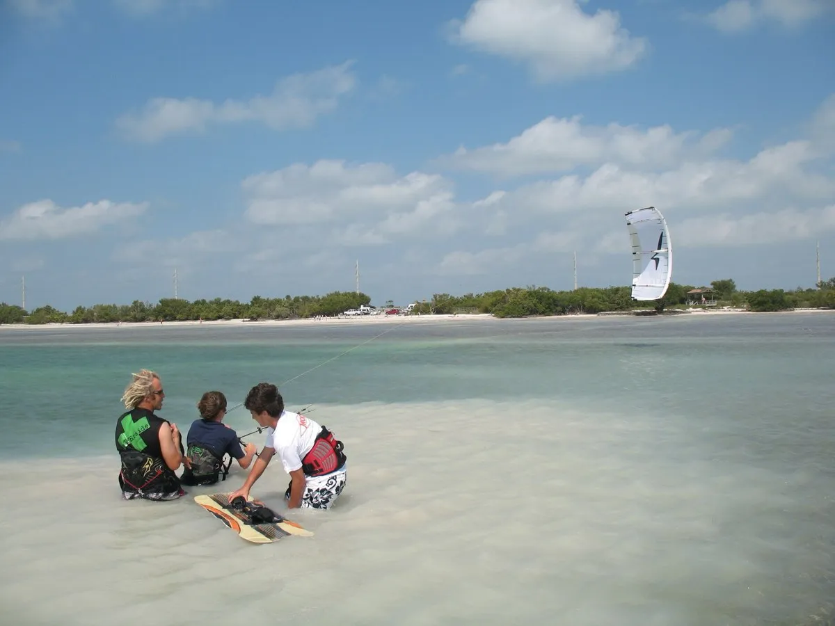
| Coordinates | 24.85°N, 80.72°W (Lower Matecumbe Key, ~MM 73) |
| Wind | E/ENE trade, 15–25 kt, Oct/Nov–May (summer lighter) |
| Water | Clear shallow flats, ankle-to-waist; deeper channel between flats for foiling |
| Relaunch room | Small rigging area at high tide; boat channel and bridge no-go zone nearby |
| Rescue | Schools nearby (Otherside Boardsports, Islamorada Kiteboarding, Goodwind) |
| Rules | No permit at Anne's; respect the bridge no-go zone |
| Level | Beginner–intermediate (foilers use the channel) |
Anne’s Beach sits on Lower Matecumbe Key around mile marker 73 in Islamorada, a natural sandy break with clear, shallow Keys flats. It is classic warm-water winter flat water — ankle-to-waist deep across the flats, with a deeper channel running between them that gives foilers real water to ride. On the E/ENE trades it holds 15–25 kt through the cool season. It reads as excellent parawing terrain, but the documented record here is kite and wing, not parawing.
Is Anne’s Beach a proven parawing spot?
No. The published sessions are kiteboarding and wing foiling — schools like Otherside Boardsports, Islamorada Kiteboarding and Goodwind operate in the area, and the flats are a well-known local venue. There is no documented parawing log confirming Anne’s for a stashed wing. The read below is inferred from those kite and wing records at the same break, not from proven parawing riding. Ride it as a candidate, not a certainty.
The good news for a parawing is that the water layout is favourable. The shallow flats are forgiving for early flat-water work, and the deeper channel gives a foiler somewhere to actually foil once the mast needs clearance.
Wind and season
The E/ENE trades are the driver, consistent from October or November through May, typically 15–25 kt, with E giving the cleanest air. Summer goes lighter and less reliable. This is a winter destination: US-1 lodging runs the length of the Keys.
Water and hazards
The trade-off at Anne’s is depth. The flats are too shallow to clear a full foil mast, so foiling happens in the deeper channel between them — which is also where the boat channel and traffic live. The rigging area shrinks at high tide, so space is tight. Two hard rules: stay out of the bridge no-go zone entirely, and respect the fishermen who work the flats. A stashed wing is invisible to a passing boat, which makes the channel-and-traffic mix the real risk to manage here — rehearse your self-rescue and drift plan before you commit.
Rules
No permit is required at Anne’s itself. Know the bridge no-go zone. Nearby Whale Harbor (MM 83.5) is a separate launch that charges a small daily fee if you need an alternative.
Before you go
Anne’s Beach is a promising, unproven parawing venue: shallow flats for control, a channel for foiling, reliable winter trades. Compare it with documented flats using the spot finder, and pick your size for the 15–25 kt window with the parawing size calculator.
FAQ
Can you parawing foil at Anne's Beach?
The deeper channel between the flats gives foilers water to work with, so it reads as a good parawing venue. But no documented parawing sessions exist yet — this is inferred from kite and wing use, not proven parawing riding.
How shallow are the flats at Anne's Beach?
Ankle-to-waist deep across the flats, which is great for flat riding but too shallow to clear a full foil mast. Foilers use the deeper channel that runs between the flats.
When does Anne's Beach work?
The E/ENE trades are consistent from October or November through May, typically 15–25 kt. Summer is lighter. E wind gives the cleanest conditions.
Do you need a permit at Anne's Beach?
No permit is required at Anne's, but you must know and stay out of the bridge no-go zone, keep clear of the boat channel, and respect the fishermen who work the flats.